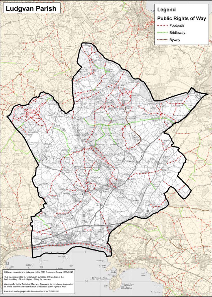
Parish Boundary
Click on this link for information on the parish boundary from May 2021, including the parish boundary changes with Nancledra and St Erth parishes.
Explore this further using Cornwall Council’s interactive map at:
Cornwall Council Interactive Map
Election boundary map from Ordnance Survey:
https://www.ordnancesurvey.co.uk/election-maps/gb/?x=151093&y=34195&z=7&bnd1=CPC&bnd2=&labels=off
Footpath Map
